
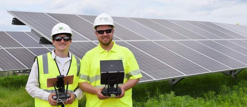
Enel Green Power North America (EGPNA) has signed a memorandum of understanding (MoU) with US-based technology company Raptor Maps to optimise the use of drones and artificial intelligence (AI) for operations and maintenance (O&M) of solar assets.
As per the terms of the agreement, the two companies will configure Raptor Maps’ software solution designed and developed for post-inspection analysis.
Go deeper with GlobalData

Discover B2B Marketing That Performs
Combine business intelligence and editorial excellence to reach engaged professionals across 36 leading media platforms.
The Raptor Solar software solution will be embedded into EGPNA’s drone hardware, which will allow real-time identification and classification of faults in the solar facilities.
By combining its drone and camera technology with Raptor Maps AI software, EGPNA team will be able to capture both infrared (thermal) and high-resolution (colour) imagery of solar assets simultaneously.
EGPNA head Rafael Gonzalez said: “The partnership with Raptor Maps on this innovative technology goes beyond demonstrations, and implements a ground-breaking solution in a responsible and scalable way.
“By combining the new software with the technologies already implemented in our plants, we have the potential to increase the efficiency of our inspections, yield more accurate results and work towards developing a more automated inspection process across all of our solar sites.”
In order to accelerate commercialisation of this new technology, the Massachusetts Clean Energy Center (MassCEC) has partly funded this project.
With this solution, the two companies intend to solve the data post-processing issue faced during drone inspections across solar plants.
Both EGPNA and Raptor Maps will initiate the project this month by implementing Raptor Solar, across all of EGPNA’s solar assets.
EGPNA intends to train and equip 30 field workers with this new technology by the end of this year.
